COLLECTION NAME:
Yale University Maps
Record
Published/Created Date:
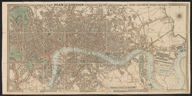
1827
Publication Place:
London :
Publisher:
G.F. Cruchley,
Extent:
1 map ;
Extent of Digitization:
Complete work digitized.
Call Number:
32 L84 1827
Format:
cartographic
Access:
Public
Rights:
The use of this image may be subject to the copyright law of the United States (Title 17, United States Code) or to site license or other rights management terms and conditions. The person using the image is liable for any infringement
Orbis ID:
8200204
OID:
15259856
Image OID:
15288051
Title:
Cruchley's New Plan of London improved to 1827 including the East and West India Docks.
Attribution:
Yale University Library
Language:
English
Genre:
Maps
Resource Type:
Maps, Atlases & Globes
Container / Volume Information:
BRBL_00049
Description:
Preliminary record.
Subject (Geographic):
London (England)--Maps
Scale:
Scale [ca. 1:12,500].
Coordinates:
12500
Image Label:
recto
Link To Source