COLLECTION NAME:
Yale University Maps
Record
Published/Created Date:
1755
Publication Place:
A Paris :
Publisher:
[Georges-Louis Le Rouge] Rue des Augustins,
Extent:
1 map : hand colored ; 62 x 50 cm
Extent of Digitization:
Complete work digitized.
Call Number:
BrSides Double Folio 2019 112
Format:
cartographic
Access:
Public
Rights:
The use of this image may be subject to the copyright law of the United States (Title 17, United States Code) or to site license or other rights management terms and conditions. The person using the image is liable for any infringement.
Orbis ID:
14038876
OID:
16708706
Image OID:
16708713
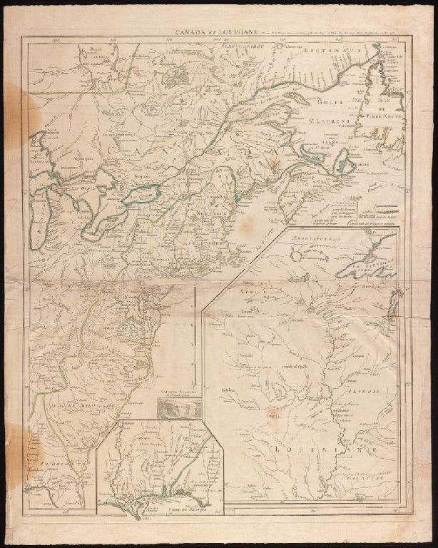
Title:
Canada et Louisiane / par le Sr. Le Rouge, ingenieur geographe du roy.
Attribution:
Yale University Library
Creator:
Le Rouge, Georges-Louis
Language:
French
Genre:
Maps
Resource Type:
Maps, Atlases & Globes
Description:
"Avec Privilege du Roi."
Subject (Geographic):
Atlantic States--Maps--Early works to 1800.
Copyright Date:
1755.
Scale:
Scale approximately 1:4,500,000
Coordinates:
(W 88°28ʹ--W 55°52ʹ/N 52°30ʹ--N 29°30ʹ).
Citation:
McCorkle, B.B. Early printed maps of New England 1513-1800, 755.23
Link To Source