COLLECTION NAME:
Yale University Maps
Record
Published/Created Date:
[between 1641 and 1658?]
Publication Place:
Amstelodami :
Publisher:
excudit Ioannes Ianssonius,
Extent:
1 map : hand col. ; 45 x 53 cm.
Extent of Digitization:
Complete work digitized.
Call Number:
70 165X
Format:
cartographic
Access:
Public
Rights:
The use of this image may be subject to the copyright law of the United States (Title 17, United States Code) or to site license or other rights management terms and conditions. The person using the image is liable for any infringement
Orbis ID:
6127300
OID:
15534124
Image OID:
15534456
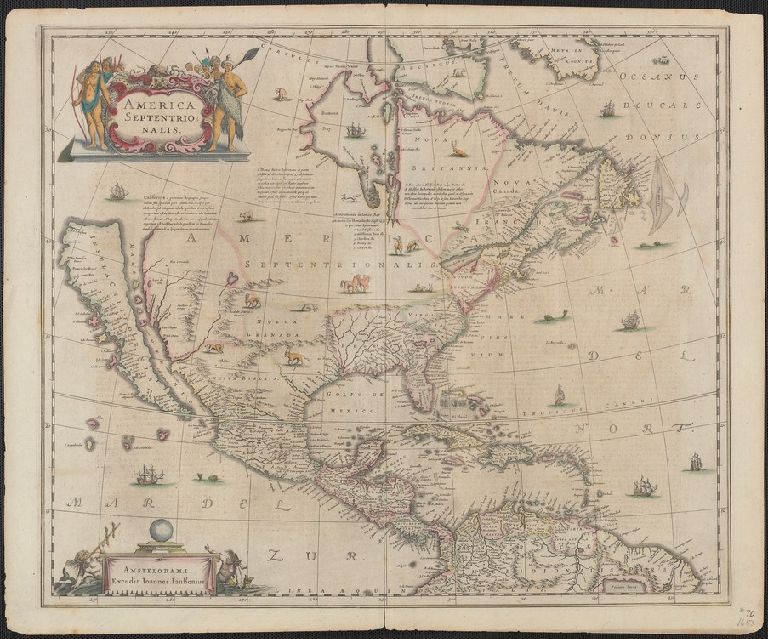
Title:
America Septentrionalis.
Attribution:
Yale University Library
Creator:
Jansson, Jan, 1588-1664
Language:
Dutch; Flemish
Genre:
Maps
Resource Type:
Maps, Atlases & Globes
Container / Volume Information:
BRBL_00353
Description:
Covers North America, Cent
Subject (Geographic):
North America--Maps--Early works to 1800
Subject (Name):
Jansson, Jan, 1588-1664. Atlas novus. Dutch
Scale:
Scale [ca. 1:18,500,000].
Coordinates:
18500000
Citation:
Burden, P.D. Mapping of North America, 245
Image Label:
recto
Link To Source