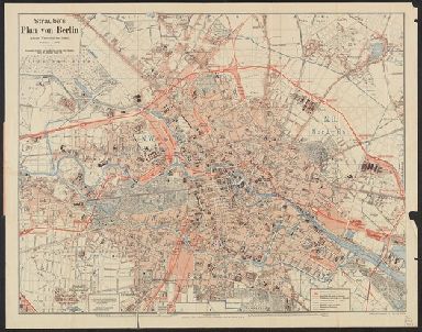
Detail View: Yale University Maps: Straube's Plan von Berlin (ganzes Weichbild der Stadt) / Zeichnung u. Stich vom Geograph. Institut u. Landkarten Verlag Jul. Straube, Berlin ; Schnellpressendruck v. C.L. Keller, Berlin.
|
Published/Created Date:
|
[1875?]
|
|
Publication Place:
|
Berlin :
|
|
Publisher:
|
Verlag des Geograph. Inst. und Landkarten-Verlag (Jul. Straube) ... Gitschiner Strasse 109,
|
|
Extent:
|
1 map :
|
|
Extent of Digitization:
|
Complete work digitized.
|
|
Call Number:
|
36 B45 1873
|
|
Format:
|
cartographic
|
|
Access:
|
Public
|
|
Rights:
|
The use of this image may be subject to the copyright law of the United States (Title 17, United States Code) or to site license or other rights management terms and conditions. The person using the image is liable for any infringement
|
|
Orbis ID:
|
6398432
|
|
OID:
|
15476431
|
|
Image OID:
|
15476796
|
|
Title:
|
Straube's Plan von Berlin (ganzes Weichbild der Stadt) / Zeichnung u. Stich vom Geograph. Institut u. Landkarten Verlag Jul. Straube, Berlin ; Schnellpressendruck v. C.L. Keller, Berlin.
|
|
Attribution:
|
Yale University Library
|
|
Creator:
|
Geographisches Institut und Landkarten-Verlag Jul. Straube
|
|
Language:
|
German
|
|
Genre:
|
Maps
|
|
Resource Type:
|
Maps, Atlases & Globes
|
|
Subject (Topic):
|
Streets--Germany--Berlin--Maps
|
|
Container / Volume Information:
|
BRBL_00122
|
|
Alternative Title:
|
Plan von Berlin (ganzes Weichbild der Stadt)
|
|
Description:
|
Legends.
|
|
Subject (Geographic):
|
Berlin (Germany)--Maps
|
|
Scale:
|
Scale 1:17,777
|
|
Coordinates:
|
(E 13.30°--E 13.47°/N 52.56°--N 52.48°).
|
|
Image Label:
|
recto
|