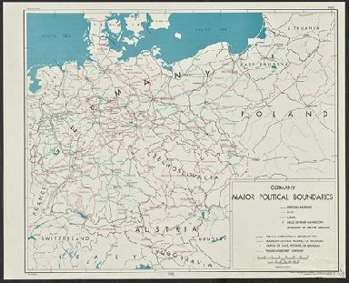
Detail View: Yale University Maps: Germany, major political boundaries / compiled and drawn in the Branch of Research and Analysis, OSS.
|
Published/Created Date:
|
1943
|
|
Publication Place:
|
[Washington, D.C.] :
|
|
Publisher:
|
R & A, OSS,
|
|
Extent:
|
1 map : col. ; 48 x 57 cm.
|
|
Extent of Digitization:
|
Complete work digitized.
|
|
Call Number:
|
36fab 1943A
|
|
Format:
|
cartographic
|
|
Access:
|
Public
|
|
Rights:
|
The use of this image may be subject to the copyright law of the United States (Title 17, United States Code) or to site license or other rights management terms and conditions. The person using the image is liable for any infringement
|
|
Orbis ID:
|
9786628
|
|
OID:
|
15479636
|
|
Image OID:
|
15480073
|
|
Title:
|
Germany, major political boundaries / compiled and drawn in the Branch of Research and Analysis, OSS.
|
|
Attribution:
|
Yale University Library
|
|
Creator:
|
United States. Office of Strategic Services. Research and Analysis Branch
|
|
Language:
|
English
|
|
Genre:
|
Maps
|
|
Resource Type:
|
Maps, Atlases & Globes
|
|
Container / Volume Information:
|
BRBL_00128
|
|
Description:
|
"Map no., 2904, 21 December 1943."
|
|
Subject (Geographic):
|
Europe, Central--Administrative and political divisions--Maps
|
|
Scale:
|
Scale [ca. 1:2,400,000]
|
|
Coordinates:
|
(E 6⁰--E 28⁰/ N 54⁰--N 46⁰)
|
|
Edition:
|
Provisional ed.
|
|
Image Label:
|
recto
|