COLLECTION NAME:
Yale University Maps
Record
Published/Created Date:
1784
Publication Place:
London :
Publisher:
Wm. Faden,
Extent:
1 map ; 67 x 52 cm.
Extent of Digitization:
Complete work digitized.
Call Number:
771hc H864 1777A
Format:
cartographic
Access:
Public
Rights:
The use of this image may be subject to the copyright law of the United States (Title 17, United States Code) or to site license or other rights management terms and conditions. The person using the image is liable for any infringement
Orbis ID:
8246297
OID:
15790091
Image OID:
15790172
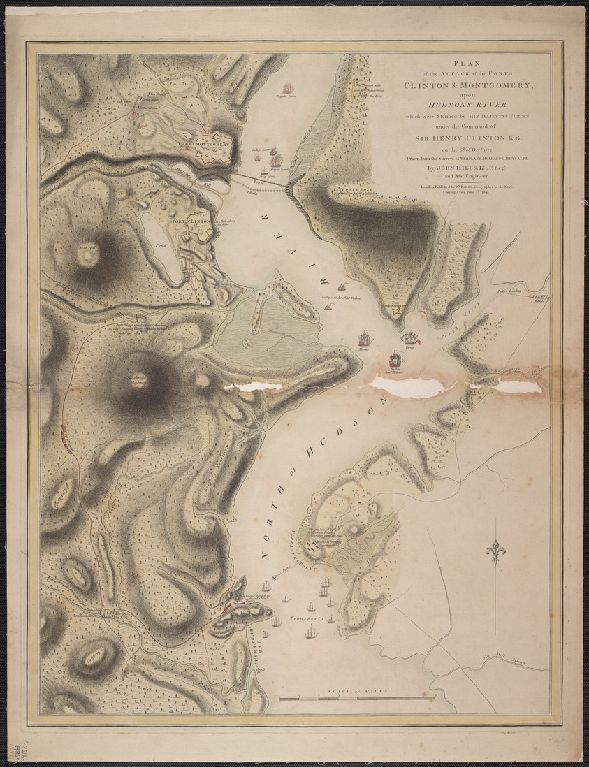
Title:
Plan of the attack of the forts Clinton & Montgomery, upon Hudson's river, which were stormed by his majesty's forces, under the command of Sir Henry Clinton, K.B., on the 6th of Octr., 1777. Drawn from the surveys of Verplank, Holland & Metcalfe. By John
Attribution:
Yale University Library
Language:
English
Genre:
Maps
Resource Type:
Maps, Atlases & Globes
Container / Volume Information:
BRBL_00495
Description:
Removed from Atlas of Battles of the American revolution, ect. London, 1793.
Subject (Geographic):
Hudson River (N. Y. and N.J.)--Maps--Early works to 1800
Scale:
Scale [ca. 1:21,300].
Coordinates:
21300
Image Label:
recto
Link To Source