COLLECTION NAME:
Yale University Maps
Record
Published/Created Date:
[1785]
Publication Place:
Phila. :
Publisher:
Mathew Carey,
Extent:
1 map ; 61 x 34 cm.
Extent of Digitization:
Complete work digitized.
Call Number:
804 1785
Format:
cartographic
Access:
Public
Rights:
The use of this image may be subject to the copyright law of the United States (Title 17, United States Code) or to site license or other rights management terms and conditions. The person using the image is liable for any infringement
Orbis ID:
8219600
OID:
15814336
Image OID:
15816450
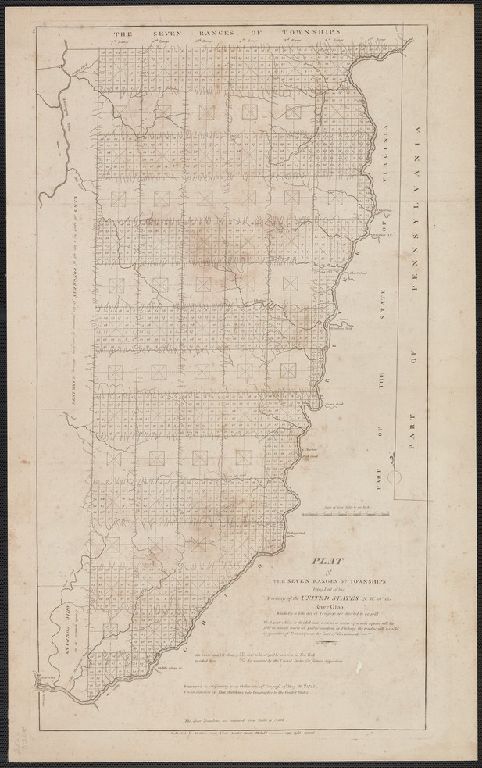
Title:
Plat of the seven ranges of townships being part of the territory of the United States n.w. of the river Ohio ...
Attribution:
Yale University Library
Language:
English
Genre:
Maps
Resource Type:
Maps, Atlases & Globes
Container / Volume Information:
BRBL_00543
Subject (Geographic):
Ohio--Maps
Scale:
Scale [ca. 1:250,000].
Coordinates:
250000
Image Label:
recto
Link To Source