COLLECTION NAME:
Yale University Maps
Record
Published/Created Date:
1650?]
Publication Place:
[London?
Extent:
1 map ;
Extent of Digitization:
Complete work digitized.
Call Number:
32gmb C167 1650
Format:
cartographic
Access:
Public
Rights:
The use of this image may be subject to the copyright law of the United States (Title 17, United States Code) or to site license or other rights management terms and conditions. The person using the image is liable for any infringement
Orbis ID:
8198736
OID:
15352164
Image OID:
15376372
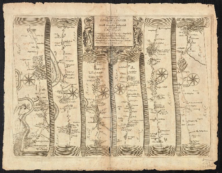
Title:
The Road from London to Dover in co. Canty. Actually Surveyed & Delineated by John Ogilby Esqr.
Attribution:
Yale University Library
Language:
English
Genre:
Maps
Resource Type:
Maps, Atlases & Globes
Container / Volume Information:
BRBL_00076
Subject (Geographic):
England--Maps--Early works to 1800
Scale:
Scale not given.
Coordinates:
a
Image Label:
recto
Link To Source