COLLECTION NAME:
Yale University Maps
Record
Published/Created Date:
1757
Publication Place:
In Roma :
Publisher:
[s.n.],
Extent:
1 map : hand col. ; 24.4 x 29.1 cm.
Extent of Digitization:
Complete work digitized.
Call Number:
70 1757
Format:
cartographic
Access:
Public
Rights:
The use of this image may be subject to the copyright law of the United States (Title 17, United States Code) or to site license or other rights management terms and conditions. The person using the image is liable for any infringement
Orbis ID:
8330594
OID:
15825268
Image OID:
15825907
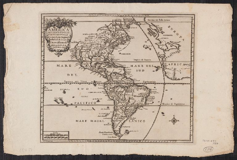
Title:
America settentrionale e meridionale : con tutte le sue regioni e classi d'isole secondo il novo sistema di Neralco P.A.
Attribution:
Yale University Library
Creator:
Polanzani, Francesco, 1700-ca. 1783
Language:
Italian
Genre:
Maps
Resource Type:
Maps, Atlases & Globes
Container / Volume Information:
BRBL_00686
Description:
"F. Polanzani, sculp."
Subject (Geographic):
America--Maps--Early works to 1800
Subject (Name):
Neralco, 1672 or 3-1759
Scale:
Scale [ca. 1:6 500 000].
Coordinates:
6500000
Image Label:
recto
Link To Source