COLLECTION NAME:
Yale University Maps
Record
Published/Created Date:
1789
Extent:
1 map ; 80 x 100 cm.
Extent of Digitization:
Complete work digitized.
Call Number:
38 P21 1789
Format:
cartographic
Access:
Public
Rights:
The use of this image may be subject to the copyright law of the United States (Title 17, United States Code) or to site license or other rights management terms and conditions. The person using the image is liable for any infringement
Orbis ID:
8225112
OID:
15826863
Image OID:
15828101
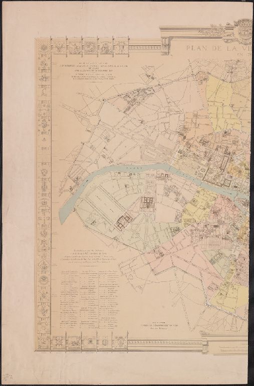
Title:
Plan de la Ville de Paris en 1789.
Attribution:
Yale University Library
Language:
French
Genre:
Maps
Resource Type:
Maps, Atlases & Globes
Container / Volume Information:
BRBL_00161
Description:
Illustrated border and various data.
Subject (Geographic):
Paris (France)--Maps--Early works to 1800
Scale:
Scale [ca. 1:10,000].
Coordinates:
10000
Image Label:
Eastern half
Link To Source